 Print Page
Print Page
Print Page
Location: London; printed by John Walker
Materials: paper, laid on linen
Dimensions: 100 x 64cm (each sheet)
Accession Number: ARC.pt 454.1-2
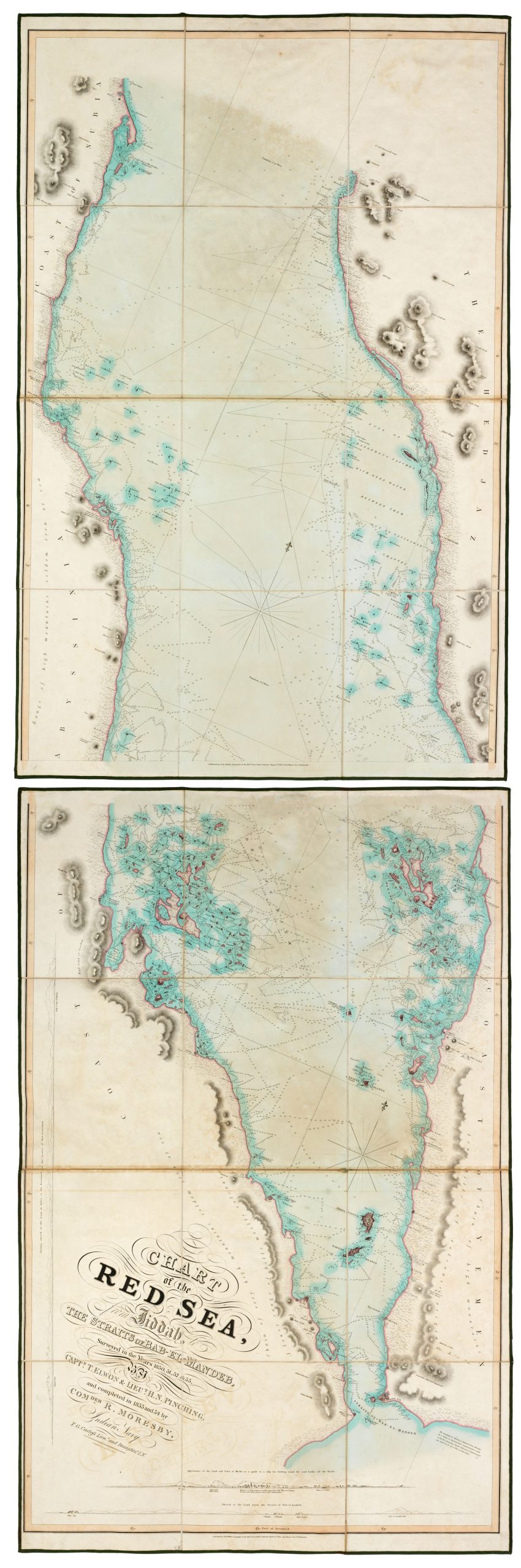
Other Notes: This is an extremely detailed chart of the Red Sea south of Jeddah, surveyed by officers of ‘Her Majesty’s Indian Navy’, with the purpose of making the new ‘Overland Route’ to India safer. It was surveyed between the years 1830–33 and completed in 1833 and 1834.
Script:
by Captain T. Elwon; Lieutenant H. N. Pinching; Commander R. Moresby; T.G. Carless Lieutenant and Draughtsman