 Print Page
Print Page
Print Page
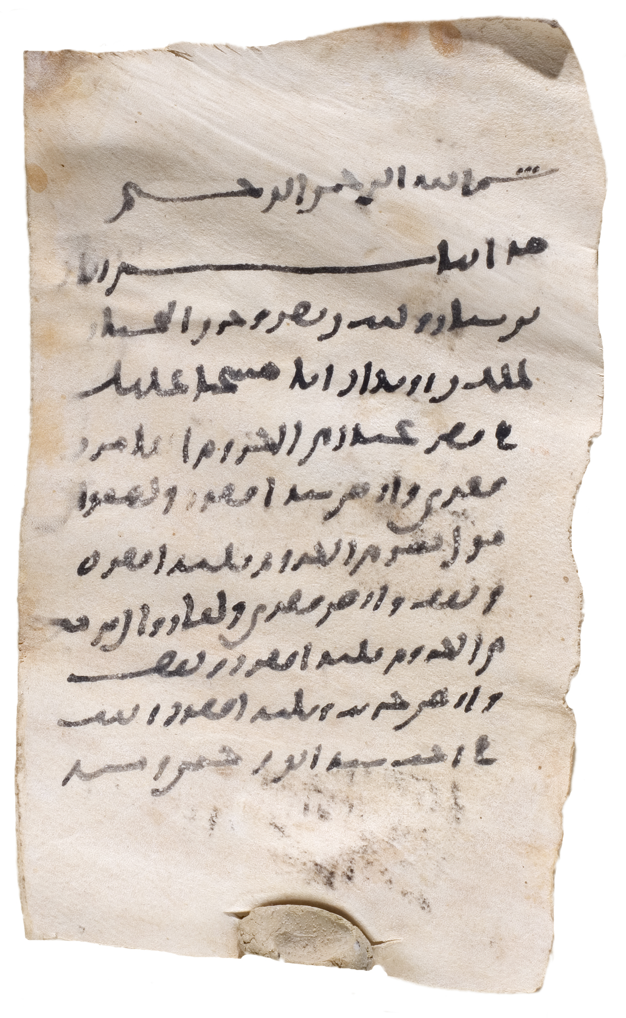
Location: Khurasan
Materials: ink on light-coloured parchment; bulla of grey-coloured clay
Dimensions: 11 x 6.9cm
Accession Number: DOC 16 [AR 24]
Other Notes:
Arabic document.
The document is an assessment of the amount of land-tax to be paid, based on an official survey of land cultivated by the persons concerned. Two categories of land are mentioned: kurum (‘orchards’), or irrigated plantations; and ’ard, or unirregated cultivated land.
The report is issued by three officials, and plots of land belonging to three people are mentioned. It is most likely that the plots mentioned are all in the vicinity of ‘the citadel of Gandar’.
The impression on the bulla is too worn to be deciphered.
Bibliography:
G. Khan, Arabic Documents from Early Islamic Khurasan, Studies in the Khalili Collection, volume V, London 2007, pp.40–42 and no.24, pp.138–9.